Saturday, May 11, 2013
Mt. St. Helens - Private Climb (05/04/13)
Having climbed Mt. St. Helens as a Mazama climb last year, I thought it would be fun to return to the mountain for a private climb. It would be a great way to get some conditioning in for other climbs this year. My plan was to organize a group of people to climb MSH in the first good weather weekend prior to the May 15th cutoff when the 100 climber per day quota goes into effect. Though there were 7 or 8 people initially interested in climbing MSH, when all was said and done, there were just three us. Beth and Kat, both of whom were graduates of Andrew Bodien's BCEP group this year, and me. Beth and Kat graciously agreed to pick up my permit the night before as they were going to camp out at the Marble Mountain Sno-Park, while I was going to drive up early in the morning. With warm weather predicted, we decided that a 5:30am meet time at the Sno-Park would be ideal.
Earmuff Snake climbed MSH three days prior and she gave me all the beta in terms of snow conditions. Plus, she left me with good kick steps and glissade chutes, at least that's what she said she did. She started at 7am and got back to her car at 3:00pm. Though I did not expect to make the round trip in 8 hours, I was aiming to beat the time from my Mazama climb of St. Helens last year of about 11 hours.
I arrived at the trailhead at about 5:15am. Beth and Kat were already packing up their tent. We agreed that we probably would not need crampons since it was 44 degrees at the trailhead, but we brought them anyway just in case. We also decided that we would need snowshoes based on my climb last year in similar conditions and on Earmuff Snake's observations from her climb earlier in the week. And, of course we had our ice axe and all the gear we would need for a successful climb.
By the time we were situated, it was 5:50 am. We started up the trail. The first 1,400 feet to the Loowit Trail intersection is a gradual incline. It took a full two hours to get to the Loowit Trail because the snow was already soft since it did not freeze overnight. We were joined by a lot of climbers and downhill skiers hoping for good backcountry runs.
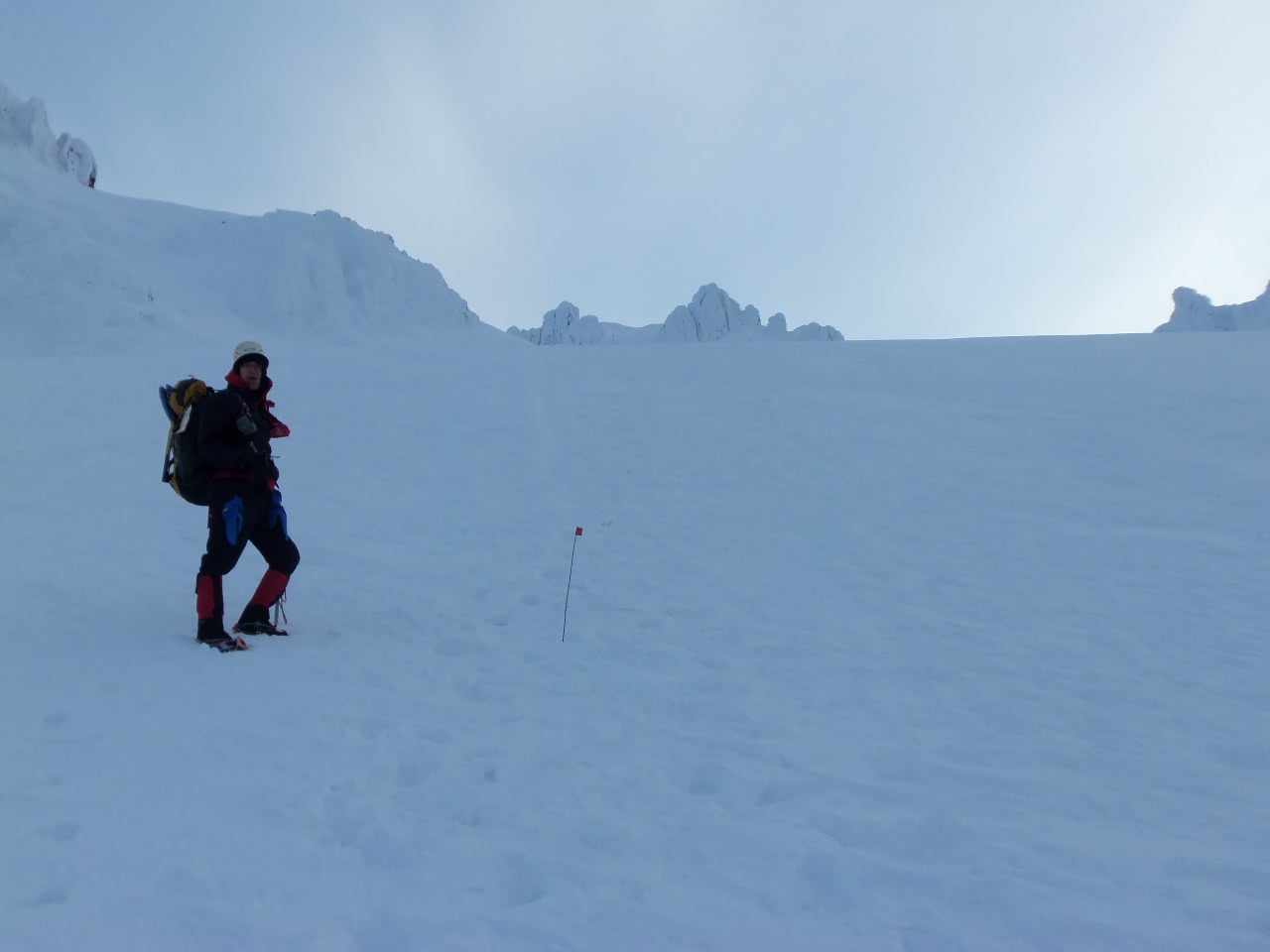
Above 4,000 feet, the incline increased. We crossed over a ridge of rocks and then continued our climb up at about a pace of 1,000 feet per hour. At that point, my co-worker, Jonathan, and his wife, who started their climb at 7am, passed us which is kind of demoralizing considering that we got over an hour head start on them. But, we continued up. The winds were very strong blowing out of the east around 30 mph with an occasional gust to 40 miles per hour. Fighting to keep balance and push forward through the wind was energy consuming. But, the weather was sunny and we had nice views of Mt. Adams to our east and Mt. St. Helens to our south to make the climb at least somewhat enjoyable. We took a few breaks along the way. Beth and Kat were the speedsters of the group and I was struggling to keep up, but I kept a steady pace and the other two did not seem to be annoyed by the slower pace due to the baby weight from my son's birth last spring that I still have not lost.
The last hill that starts at about 7,300 feet all the way up to the rim was the toughest just because so much energy had already been expended. We saw ahead of us a long line of people on the boot bath heading to the rim. We finally summitted at just after noon. I counted about 75 people on the rim itself when we arrived. A ranger who kept pace with us throughout the climb estimated there were 300 people out climbing Mt. St. Helens.
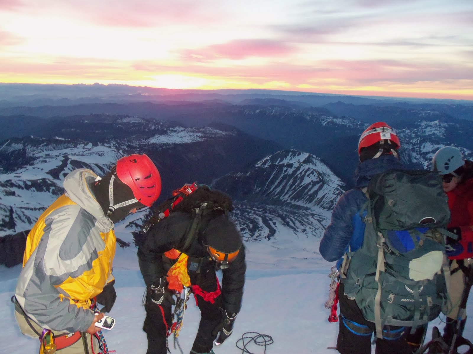
Once at the summit, we took pictures and ate lunch. The cornices were not as scary as last year, but of course, I was careful not to get to close to the edge. We saw some steam coming out of the crater which I thought was neat and had nice views of Mt. Rainier to our northeast. After eating our lunch and taking some photos, we prepared our glissade gear and headed down the mountain. Since it was so warm, the glissade chutes had soften up, but we still had good enough paths to get down quickly. Our last glissade took us to nearly the 4,000 foot level where we intersected with the Loowit Trail. At that point, we put on the snowshoes and then trudged our way pack to the car arriving at 4:05pm. 10 hours and 15 minutes was definitely an improvement from last year, but I would still like to increase my climbing speed to get down to that 8 hours. I said my goodbyes to Beth and Kat and headed home for a nice steak dinner.
I've decided that I'm going to try climbing MSH every year prior to May 15th for the conditioning. MSH is a simple, straightforward climb as long as you are in good physical condition for the 5,500 foot ascent, and that you have the appropriate gear (crampons, snowshoes, etc.).
See the complete photo album here: Mt. St. Helens photos
Sunday, February 10, 2013
Glacier Snake Climb: Mt. Daniel (2012 Mazama Climb 090)
Mt. Daniel, at 7,960 feet, is the highest peak in both King
and Kittitas Counties in the Alpine Lake Wilderness. The Alpine Lake Wilderness itself is a beatiful area in the central Washington Cascade range and the wilderness contains other spectacular peaks such as Mt. Stuart, Dragontail, and Colchuck Peak. Mt.
Daniel itself is made up of five peaks:
West Summit, Middle Summit, East Peak, West Pyramid and Northwest Peak The West Summit is the true summit even though topo maps state that the East Peak is. Since the West Summit is the true high point, it was our objective for the climb.
We met at the Cathedral Pass trailhead on Friday afternoon
with an anticipated departure time at 1:00pm. My carpool buddy, Andrew, and I were the
first car there. We made great time
leaving Portland at 6:00am and arriving in Cle Elum just after
10. We drove through Roslyn (think
Northern Exposures TV show) and then to Forest Service Road 4330 where we would drive 10 miles to Tucquala Lake which is where
the Cathedral Pass trailhead is. Because the roads were
so bad, it took us an hour to travel the final 10 miles. Though we were ontime, the rest of our
climbing party was delayed by the road conditions. Fortunately for
me and Andrew, we had more than enough time to prepare our packs, eat our
lunches, and get situated. After the
other vehicles showed up, we split our group gear, did introductions, and began
our climb around 2:30pm.
As the title suggests, this was a Glacier Snake Climb led by
Obi Wan Danobi Snake (Daniel). Also on the climb
was Hungry Snake (Dan). We had two new Glacier
Snake graduates who would be officially named during the climb. The Cathedral Pass trail crosses the Cle Elum River at around 3,200 feet elevation and then immediately ascends about 1,600 feet to the top of a ridge. Once on the top, it was a short hike to Squaw Lake where we took a break, ate some food, and traded ropes. We continued northward and climbed another 800 feet to Cathedral Pass enjoying views of Cathedral Rock directly ahead of us and Mt. Stuart off in distance behind us. Once at the pass, we turned onto the Peggy's Pond trail which is not maintained and required some downclimbing as we scooted around the southwest side of Cathedral Rock. We had to cross two separate snowfields , one of which had a significant runoff that required us to scramble up and around the snow. Slowly, but surely, we made our way to Peggy's Pond which was only partially melted out. There were enough melted out areas where we all were able to set up our tents on the rock instead of the snow. After setting up tents, we made dinner, filtered water, and Obi Wan Danobi Snake informed us that we would leave at 6:30 the next morning.
Though the winds picked up overnight, I was able to get a reasonable night's sleep. The next morning, we rolled out of our tents, ate breakfast, put our climbing gear together, and headed off at around 6:45am. West Summit is not visible from Peggy's Pond, but East Peak is. We knew that to get to West Summit we would have to get to a saddle directly south of East Peak. So, we started up a hill directly to our west which would soon become the southeast ridge of the mountain. We did not need crampons, though we did carry them with us. We kicked stepped our way up the snow. The snow did not entirely set overnight, yet it was firm enough to get some good steps in. We were more or less in the snow for the first 1,000 feet above Peggy's Pond and then when the ridge became more defined, we were able to move onto a primitive dirt trail with cairns leading the way. Directly below us to our south, we enjoyed views of Venus Lake, Circle Lake, and Spade Lake. Venus and Circle Lakes were just starting to melt out and waters below were a beautiful light blue color. Mt. Rainier and Mt. Adams were easily visible beyond the lakes.
At around 7,000 feet our ridge curved to the north and though we saw a traverse across the snow to the East Peak Saddle, we decided to scramble up the sometimes 3rd class rock because some in our climbing party thought it would be more fun. We were making good time and though it was starting to warm up, the energy level of the entire group was still strong. The scramble did not cause us any major problems until right before the saddle where there was a minor gendarme that was too sketchy to get around without protecting because the dropoff was significant. So, Obi Wan Danobi Snake and his assistant, Chelsea, set up a fixed line while the rest of us put on our harnesses.
We made it around gendarme easily, but then the trail descended below the ridgeline before climbing back up to the saddle of East Peak. It was here that a couple of climbers got really nervous because the trail itself is sketchy and the angle of the drop off is significant. We all made it to the saddle safely and started to the northwest towards Middle Summit. We saw a high angle snowfield that we would have to cross ahead of us, but before we got there, the climbers who probably never recovered from the previous section, became sketched out because of the dropoff below the trail. Though they tried to continue, it became clear that the next section would be to nerve wracking to go on. A few of us felt that we could safety continue on the trail if we proceeded carefully, but with members of the group who did not feel the same way, Obi Wan Danobi Snake rightfully had us regroup and we discussed our options. Obi Wan Danobi Snake made the call to return to the saddle and there we decided not to proceed towards West Summit. Since East Peak was right there, and it became clear that it was nothing more than a 3rd class scramble, we decided to scramble to the top and there we treated to terrific views of West Summit and Middle Summit to our west, Mt. Rainier to the south, Glacier Peak to the northeast, and Mt. Stuart to the east. Obi Wan Danobi Snake declared that he would issue Summit Certificates for Mt. Daniel - East Peak. We took a lot of pictures while on the summit and then descended back to the saddle.
From the saddle, we plunge stepped our way down to the boot track that we saw across the snow coming up. The boot track would bring us back to the southeast ridge. With our ice axes out, we carefully traversed the snowfield and made it back to the dirt exposed trail. We descended safely down the southeast ridge and back to our campsites at Peggy's Pond around 5pm. Back at camp, we enjoyed a relaxing dinner, then we filtered water and headed to bed.
We woke up the next morning, packed up camp, and headed back to Cathedral Pass, Squaw Lake, and eventually the trailhead. We were back at the cars by 10:30 am. We drove into Cle Elum and had brunch at the Sunset Cafe. At brunch, I learned an important lesson: Prime rib is not a very good filling for an omelet. A few people had Bloody Mary's which was the advertised drink special. We watched the opening weekend events of the Olympics on TV. Obi Wan Danobi passed out Summit Certificates and then we said our goodbyes and drove home.
It was too bad we did not climb the West Summit on this trip, but it is perfectly understandable the reasons for stopping short. When climbing, safety is always the most important consideration, and we did the prudent thing. The Alpine Lakes area is so beautiful, that climbing or hiking anything in that area is well worth it.
And congrats go out to our newly initiated Glacier Snakes. Maika became known as "Nanny Goat Snake" because her laugh sounds like a nanny goat. And, Annie became "What What Snake" due to her expression "What what in the butt."
To see all the photos from this climb, go to Mt. Daniel climb photos
From the saddle, we plunge stepped our way down to the boot track that we saw across the snow coming up. The boot track would bring us back to the southeast ridge. With our ice axes out, we carefully traversed the snowfield and made it back to the dirt exposed trail. We descended safely down the southeast ridge and back to our campsites at Peggy's Pond around 5pm. Back at camp, we enjoyed a relaxing dinner, then we filtered water and headed to bed.
We woke up the next morning, packed up camp, and headed back to Cathedral Pass, Squaw Lake, and eventually the trailhead. We were back at the cars by 10:30 am. We drove into Cle Elum and had brunch at the Sunset Cafe. At brunch, I learned an important lesson: Prime rib is not a very good filling for an omelet. A few people had Bloody Mary's which was the advertised drink special. We watched the opening weekend events of the Olympics on TV. Obi Wan Danobi passed out Summit Certificates and then we said our goodbyes and drove home.
It was too bad we did not climb the West Summit on this trip, but it is perfectly understandable the reasons for stopping short. When climbing, safety is always the most important consideration, and we did the prudent thing. The Alpine Lakes area is so beautiful, that climbing or hiking anything in that area is well worth it.
And congrats go out to our newly initiated Glacier Snakes. Maika became known as "Nanny Goat Snake" because her laugh sounds like a nanny goat. And, Annie became "What What Snake" due to her expression "What what in the butt."
To see all the photos from this climb, go to Mt. Daniel climb photos
Tuesday, August 21, 2012
Unicorn Peak (2012 Mazama Climb 192)
Last year, a group of us tried to climb Unicorn Peak, but because of snow conditions, we had to turn around at Snow Lake. This year, we had much better climbing conditions, though weather was going to be the biggest obstacle to a successful summit.
Unicorn Peak is one of the numerous peaks on the Tatoosh Range, immediately south of Mt. Rainier in Mt. Rainier National Park. From the road to Paradise Lodge, Unicorn Peak looks like, well, a unicorn. It has this rock formation that sticks out just like a unicorn's horn. The summit of Unicorn is 6,917 feet with approximately 2,400 feet of elevation gain from the Snow Lake trailhead.
This was the third attempt this year to get this climb underway. Our leader, Mike Holman, originally had this climb scheduled for mid May but it was postponed due to snow conditions. Our second opportunity was in early June, but we were thwarted by bad weather. This was the third and final opportunity because of Mike's summer schedule. He was going to make a go of this climb unless the weather was appalling. The forecast was for 90% chance of showers.
Since I was driving to Olympia immediately after the climb, I drove on my own and arrived at Cougar Creek campground around 11pm. I got up at 5 the next morning and met the rest of the group at the campground. We drove up to the trailhead and met our final two climbers who had driven up that morning. One of those climbers was our assistant leader, Tom, aka Opa Snake of Glacier Snake fame (see previous Glacier Snake climb posts).
We never did do formal interviews or a group meeting, we just got our gear together and started up the trail just before 7:30am. Aside from a few melted out patches, most of the entire trail was covered in snow. But, we knew the route to Snow Lake, about a mile from the trailhead. Not more than 10 minutes after we started to climb, the rain came. It was a light rain, but we were getting nervous because we knew we could not climb the summit pinnacle safely if the rock was wet.
Around 8:30, we arrived at Snow Lake where we took a break to eat and adjust gear. Much to our surprise, the clouds started to lift, and there was blue sky visible behind Unicorn Peak. It looked like the rain was not more than a passing shower.
Immediately after Snow Lake, the trail ascends the first of two chutes. It was here where last year cornices on top of the chute made the climb to dangerous to continue. This time there were no cornices present. We had put on crampons at our Snow Lake break, so we were able to ascend the 500 foot chute easily as the snow was well packed. Once on top of the chute, the trail levels out a little, though we were still ascending. Right before the second chute, we took a food break. Fog rolled in and then lifted, but the rains stayed away. We continued zigzagging up the second chute which seemed steeper than the first, at least it appeared that way when looking down. Soon, we came to a small ridge about 400 feet below the summit that indicated we were almost to the top.
We turned east and without too much heartache, we came to the base of the summit block. We put on our harnesses and Mike and two others set up a fixed line to get to the summit and set up a rappel station as well. The idea was we would climb up the fixed line, spend some time on the summit, then rappel off the other. As it turned out, we had a strong enough group where we all moved up the 5.0 rated route quickly, enjoyed time on the summit, then rappelled back to the base of the block using both the fixed line and rappel lines simultaneously. The views of the summit were satisfactory but the clouds did obscure our views of Mt. Rainier directly to the north. Once on the base, we put our harnesses away and enjoyed "leader treats" of strawberry shortcakes made from strawberries I had picked the day before, and yes, I brought a can of whipped cream.
The descent back to Snow Lake was fast because we glissaded down both chutes. The snow conditions combined with the slope made the glissades fast but were within safe operating limits. In no time at all, we were back at the Snow Lake trailhead just after 3:30pm. Not bad work for 8 hours of climbing. Afterwards,we went to the Copper Creek Inn for food and drink before departing for home.
I loved the climb. It was a lot of fun and not too difficult. A real advantage of this climb and other climbs in the Tatoosh Range is that is so easy to get to. From Portland, it is only a 2 1/2 hour drive to the entrance of Mt. Rainier National Park. And the views from the Tatoosh are phenomenal For more photos of my Unicorn Climb, go here: Unicorn Peak Climb 06-24-12
Sunday, August 19, 2012
Mt. Hood Climb (2012 Mazama Climb 67)
There are some challenging mountains that I've climbed that I've been able to summit on the first attempt (Mt. Rainier, Mt. Shuksan, Middle Sister), but others that I just can't seem to conquer. Mt. Hood happens to be one of them. This was the third attempt to summit Mt. Hood. The first time we had to turn around at the top of the Palmer Glacier due to high winds, and second was cancelled in town because of inclement weather. Surely, third time would be a charm. The climb leader was Andrew Bodien. I had climbed The Castle in the Mt. Rainier National Park in 2010 with him. I've known Andrew for a while as he has been leading hikes, camping trips, and rock climbing adventures for the Adventurous Young Mazamas for a number of years.
This climb was originally scheduled for May 23rd but was cancelled due to weather. Andrew rescheduled the climb for Tuesday May 29th, the day after Memorial Day. I was a little nervous about the weather because over the Memorial Day weekend, there was plenty of rain in Portland and snow up on the mountain. As the climb date got closer, the weather window looked like it would improve and we might actually be able to climb. There was some wind expected but it would was forecast to decrease as the night wore on.
Our group of 11 met at the Timberline Lodge climber's register at 12:01am. After getting our gear together and Andrew filling out the necessary permits, we had a brief meeting with introductions and a review of the game plan for the climb. I noticed that the winds were strong at Timberline. Andrew reminded us that the winds were forecast to decrease and he was encouraged because there was better visibility than he had anticipated.
Our group set off at 12:30am. We hiked up the climber's trail past the Magic Mile ski lift, Silcox Hut, and the Palmer ski lift taking breaks along the way. There was a quarter moon setting off to our west and the stars filled the nighttime sky. However, the wind continued to blow strongly from the west. At about the 7,500 foot level, three climbers decided to turn around. One climber was not feeling well and the other two climbers were uncomfortable with the winds. With about 1,000 feet to go until the top of the Palmer Glacier, Andrew told the other 8 of us that we would reassess the situation at our Palmer Glacier rest break. We were hoping the winds would decrease and sometimes, when the conditions are right, the winds will actually be less strong the higher in elevation we go.
We got to the top of the Palmer Glacier at 3:15am. The winds continued to blow strongly, but we remained hopeful that the winds would die down. We put on our crampons, ate some food and drank some water, adjusted our clothing, and continued up the Triangle Moraine.
The Triangle Moraine is a much steeper section and unfortunately, with the new snow over the weekend, there were no footsteps for us to follow, so we had to kick step our way up. The higher we traveled, the slower the pace got. I know I was starting to get tired from not having sufficient sleep the day before, but I kept chugging along. A couple of other climbers seemed to be slowing down as well. We took breaks as needed, but we never regained a pace necessary to complete the climb.
At 6:45am, we reached Hot Rocks at the elevation of 10,100 feet. We had climbed over 4,100 feet and only had 1,100 feet to go. Ahead of us was the Hogsback and the Old Chute. We could see a couple of climbers ascending the Old Chute to complete the climb. Due to snow and ice melt during daylight hours, it is very dangerous to be in the Old Chute or Hogsback after sunrise because of potential ice and rockfall. Andrew said it would take us another two hours to summit because he would have to set pickets and we would have to get into rope teams. Plus after the summit, we would still have to climb down the same chute. After further discussion, it was decided to end the climb at Hot Rocks. With a warm temperature day forecast, it was not worth the risk of injury to go for the summit.
We finished our break and then turned around to descend. While glissading was discussed, the snow was too icy to do so safely, so with our crampons on, we descended down to the Palmer ski lift, took another break where we put away our crampons, and then continued our hike out to Timberline. We arrived at the lodge a little after 10am. After packing our gear in the cars, we went to the Huckleberry Inn in Government Camp and had breakfast. Andrew recommended the huckleberry pancake short stack which didn't disappoint. After breakfast, we said our goodbyes and then drove back to Portland arriving around 1pm.
It was unfortunate that we ran out of time on this climb. The big problem was our pace slowed after reaching the top of the Palmer Glacier. If we started an hour earlier, we may have made it to summit on time, but climbing is unpredictable too. There could be perfect conditions with really strong climbers and for whatever reason you still can't reach the top. I know for me personally, I need to rethink how to climb Mt. Hood because I got so tired heading up the Triangle Moraine. Maybe if I can find a way to sleep for a few hours at the trailhead or in Government Camp prior to the climb I will feel fresh and have sufficient energy to keep a good pace.
Though we didn't reach the top, I still had a great time and I will try Hood again next year.
For the complete photo album, go here: Mt. Hood Climb 05-29-12
Sunday, June 17, 2012
Mt. St. Helens (2012 Mazama Climb 123)
The second weekend of May is typically one of the busiest times to climb Mt. St. Helens because it is just before the 100 climber per day quota goes into effect on May 15th. Prior to that day, there is no limit on how many climbers can ascend MSH. The last two years, I had thoughts of climbing St. Helens on the Mother's Day weekend, but the weather was never cooperative. This year, with the forecast to be sunny and the warmest weekend so far in 2012, and with no prior commitments, I asked for and was granted permission by my wonderful wife to climb.
I saw there were a number of openings for Mazama climbs over the weekend, but the only climb on Saturday was Greg Wilmarth's climb. If I want my marriage to last, I am certainly not going to climb on Mother's Day. Though, the thought of climbing Mt. St. Helens on Mother's Day in a dress in honor of our mothers, as many people do, did go through my mind.
Greg wanted to get an early start because of an elevated avalanche danger. He decided to meet at 5:00am at the Marble Mountain Trailhead and start the climb by 5:30. While some members of the team camped out at the trailhead, since I live in Vancouver, I drove up the morning of the climb. I arrived at the trailhead at 4:30, met the team at 5, and after introductions and a brief team meeting, we hit the trail at 5:29am.
The first thousand feet of the climb is basically a hike up cross country ski trails. The snow was hard enough to where we did not need snowshoes and is not steep enough to need crampons. We ascended the 1,000 feet in about an hour taking a few short breaks to delayer. It was somewhere in the second hour of the climb that I realized that I had forgotten to put up my Northwest Forest Pass in my window. Of course I was not going to turn around at that point, I just hoped that there would not be a parking ticket by the USFS awaiting my return.
It did not take long for us to get out of the trees and to see our first views of Mt. St. Helens basking in the morning light. At around 4,000 feet, we came across a flat area where there were about 10 tents set up and numerous people, many of whom were already wearing their Mother's Day dresses , were getting ready for their climb. We stopped there to put on our sunscreen, crampons, and to eat a snack.
We continued upwards and we could clearly see specks in the distance that were other climbers going up the mountain. Because of all the people climbing and because we had a period of nice weather, we had plenty of footsteps to follow and very few new kick steps to create.
The weather warmed up pretty quickly, but we kept pushing upwards. The snow was softening up which made crampon travel a little harder, but we continued to make good time despite our pace slowing down. Unlike Mt. Adams where there is one "false summit" to attack, Mt. St. Helens seemed to have multiple false summits. We would ascend a section thinking that this was it, only to see another section slightly steeper than the last, and this happened over and over until we finally got to 8,200 feet where we saw our last push off to our northeast. Though we were all getting tired, we slogged through the last hill and reached the summit at 11:45am - 6 hours and 15 minutes after we started.
We took a break at the summit. A forest ranger who we had seen on our last push to the top warned us all of the dangers of the cornices and told us not to get to close to the crater rim. Of course we listened to her advice and stayed away from the edge even though it prevented us from having a clear view of the crater itself. But, we did have great views of Mt. Rainier to the north, Mt. Adams to the southeast, Mt. Hood to the south, and Mt. Jefferson way off in the distance behind Hood. After taking our summit photos and eating our lunch, we put away our crampons and put on our nylon pants and garbage bags for our glissade down.
Despite the softening snow, we still had great glissading conditions. Previous climbers had already created solid glissade paths so we just followed those all the way down to tree line. When all was said and done, we had glissaded down about 4,000 feet. It is remarkable how it takes hours of climbing to gain the elevation only to lose it in a few short minutes. We got of our glissade gear and since the snow was so soft, we put on the snowshoes to finish our hike out to the trailhead. We arrived back at the cars slightly after 4:00pm and I did the "happy dance" when I saw that there was no parking ticket on my windshield.
It was a great climb overall. The most challenging part of this climb is the amount of elevation gained. It is 5,500 feet from the Marble Mountain Trailhead (winter route) to the summit. But it is a good conditioning climb. I'd highly recommend climbing during the "winter conditions" because of opportunity to glissade at the end. And, regardless of your gender, don't forget to wear your dress if you climb on Mother's Day in honor of your mothers, the mother of your children, and those who have been like a mother to you.
All of my Mt. St. Helen's photos can be seen here:
Mt St Helens Climb Photos
Tuesday, October 4, 2011
Mt. Thielsen (Mazama Climb 265)
Anyone who has gone to Crater Lake, Diamond Lake, or the Southern Oregon Cascades will immediately recognize the pointed Mt. Thielsen, often referred to as the "Lightning Rod of the Cascades." The mountain's shape is imposing, perhaps even intimidating, but there's a secret about Thielsen... it's summit block is only a 5.0 climbing route, in fact Summitpost considers the difficulty of the summit block as 4th class. I had seen and read about Thielsen to know that it was a mountain that I wanted to climb, so I applied and got onto an end of September climb led my Mazama Climb Leader, Paul Underwood.
Though we were anticipating a full 12 person climb, two late cancellations and one no-show decreased our numbers to nine. The plan was to drive down to the West Thielsen View Campground on the west side of Diamond Lake on Thursday night and meet at the trailhead Friday morning at 7:00am. I rode down with one other person and we arrived at the campground at 10:45pm. We woke up at 6:00, ate breakfast, packed up our gear, and drove to the trailhead. After introductions, discussing the plan for the climb, and divvying up ropes and group gear, we started up the trail at 7:30am. The weather was a hazy sunshine. Aware that a cold front was approaching, we kept our eyes on the skies for any sign of building thunderstorms or otherwise inclement weather.
The first four miles up to the intersection of the Pacific Coast Trail was uneventful. The well maintained trail weaved through a pine tree forest with occasional views of Mt. Thielsen above and Diamond Lake below. We reached the intersection of the PCT at 9:15. From the PCT, the official trail ends, but there is enough indication of a trail to lead us all the way up to the summit block itself. Above the PCT, our trail increased in steepness significantly, but we kept going noticing that the winds had picked up dramatically. Paul stopped us for a break about 500 feet below the summit block and told us that he had concerns of the changing weather and reminded us all to keep an eye out for developing thunderstorms or a further increase in winds that would make travel too dangerous.
Though the winds never decreased, they never increased either We continued up the loose rock until we reached the summit block around 11:30. There we took a lunch break and put on our harnesses while Paul and the assistant, Gary, set up a fixed line. Once that was set, Paul and Gary went to the summit to set up a rappel while the rest of us, while monitored by a very capable climber, Kellie, attached our prusiks to the fixed line and made the climb to the top.
Since the summit itself is small, there was only room for two people at the high point, so Paul and Gary had set up a system where after climbing to the summit, we would each get a short break to take pictures and sign the climbing register, then we would rappel so others could get to the summit. The system worked well and I was back to the base of the summit block after a quick rappel down. From the summit, I could see part of Crater Lake, Diamond Lake, the three Sisters off in the distance, and a lot of smoke from forest fires both to the east and south of Thielsen.
Soon, all nine of us had completed the summit, so we took a break for "Leader Treats," coiled the ropes, put away our harnesses, and began our climb down. Despite a minor slip and fall on a steep section of rock, all of us made it back to the trailhead safely around 5:45pm. Though camping a second night was an option, all of us decided to drive back to Portland that evening. I was home and in bed before midnight.
Mt. Thielsen is a fun mountain to climb and I would definitely do it again. After reading the Summitpost description of the mountain, one may be tempted to climb to the top without ropes, but I wouldn't recommend it. Take the time to set up the fixed line because there are a couple spots where a wrong step could lead to a bad fall.
For the complete album, click on the photo:"
![]() |
| Mt. Thielsen Climb 09/30/11 |
Thanks to Paul for leading the climb, Gary for assisting, and to Howie, April, Adam, Kellie, Michelle, and Bob for a fun climb.
Thursday, July 14, 2011
Mt. Rainier (Mazama Climb 004 and Glacier Snake Climb)
Having grown up in Olympia, I had great views of Mt. Rainier from my bedroom window. Over the many years of looking at that 14,411 foot peak, I never thought that I would one day be climbing it. This summer, I had the opportunity to climb Rainier on a Mazama climb led by Bill, aka Papa Snake. Bill is one of the leaders for the Basic Climbing school (BCEP) with the Mazamas. His BCEP group is called the "Glacier Snakes" and I am one of his assistants. A number of other Glacier Snakes assistants were on the climb, such as Hungry Snake (Dan) G-Snake (Geoff), Obi Wan Danobi Snake (Daniel), Sneaky Snake (Caleb), and Brian, who has yet to be named. It's always nice to climb with people I already know or with whom I have climbed in the past because it makes climbing safer and more fun.
Though Mt. Rainier can be done in three days, Bill wisely scheduled the climb as a four day affair. Day 1 would be a strenuous hike from the trailhead to Camp Schurman, day 2 would be a rest day, day 3 would be summit day, and day 4 would be our pack out. Mt. Rainier is not a technically difficult climb, in that there is no rock climbing or crazy ice climbing involved, but it is a climb that is physically demanding. The presence of crevasses is the main risk to one's safety, though altitude sickness can be a major challenge in summitting Rainier.
Mt. Rainier has numerous routes in varying degrees of difficulty. The Disappointment Cleaver, also known as the "DC", on the southeast side of the mountain, is the most popular route. We would be climbing the Emmons Glacier route on the northeast side of the mountain. The Emmons route receives approximately 15% of the 10,000 summit attempts every year. Though it has more altitude gain than the DC, it has fewer crowds and is somewhat less technical from what I have had heard and read.
Day 1: White River Campground to Camp Schurman
The twelve of us on the climb met at the White River Ranger Station at 9:30 on Friday morning (7/8/11). There we obtained our climbing permits. The rangers gave us a short lecture on available water supplies, disposing of human waste, food storage, snow conditions, and anticipated weather. We left the station and drove to the White River campground which is also the parking area for climbers. We loaded up our gear and started up the Glacier Basin trail at 10:30am.
I had the feeling that the pack in to camp would be the most difficult of the four days, and is it turned out, I was right. On Day 1, we had to ascend 5,400 feet cumulative with a full pack, mine weighing about 55 pounds at the trailhead. In our first leg we ascended 1,500 feet over 3.2 miles to Glacier Basin which is a back country camping area at the base of the Inter Glacier. There we stopped for lunch, refilled water at the stream, and reapplied sunscreen. From there, we began the ascent up the Inter Glacier. We gained over 3,000 feet up to Camp Curtis, a ridge between the Inter and Emmons glaciers. The daytime heating softened the snow and there was a clear boot track all the way to Camp Curtis. We wore crampons but we did not need to rope up. The travel up the Inter Glacier was challenging because it was warm and with the sun shining directly on me, my energy was being depleted quickly despite eating plenty of food and drinking a lot of water. Finally, around 5pm, our tired group got to Camp Curtis. There, the winds were blowing hard and we were starting to lose the afternoon heat, so we quickly put on our harnesses and roped up for the descent onto the Emmons Glacier and then a 500 foot rise to Camp Schurman. We roped up because there were a number of crevasses beginning to open up.
The last stretch to Camp Schurman was the most difficult for me because my energy was gone. The first two rope teams got to the camp around 6:15, and my rope team, led by Obi Wan Danobi Snake, arrived at 6:30. The winds at Camp Schurman were not as strong as at Camp Curtis, but they were still brisk. We set up our tents, got unpacked, and began boiling water for dinner. After eating a tasty Mountain Home freeze dried lasagna dinner, we melted and filtered some water and went to bed around 9pm.
Day 2: Rest Day at Camp Schurman
The second day of our trip was a rest day. It is possible to depart for the actual climb at any of time of the day or night, but it was decided that we would have an alpine start of 2am on the third day. The advantage to the alpine start is since we don't have the daytime heating during the climb up, the snow will have had a chance to firm up overnight making glacier travel easier, and it makes snow bridges over crevasses a little more secure.
On Day 2 we just hung around camp. We had a leisurely breakfast, read our books and magazines, took a nap, and had some time to converse with each other. We had lunch and started some preparations for the climb. The day went by very quickly, so by early evening, we made our dinners, repacked for our climb, and off to bed at 8pm. Though the sun sets over the Wilson Glacier at 8, it doesn't get dark, until well after 9. And, since I don't sleep well in the light, I didn't fall asleep until closer to 10pm. A few short hours later, it was the 1am wake up call.
Day 3: Climb Day
Everyone's alarms went off at 1. We got up, got dressed, had a quick breakfast, put on our layers, crampons, and harnesses, and got onto our rope teams at 2. I would be on rope team 1, position 3 of 4. Admittedly, I was a little scared to be in team 1 because I know Papa Snake to be a moderately fast hiker and climber where I am slower. Furthermore, Papa Snake told all of us that if one person cannot reach the summit, the whole rope team doesn't make it. The crevasses are too dangerous not to be roped up. A person on team 3 was having some crampon issues, so we did not leave camp until 220am. To my pleasant surprise, I was able to keep up with Papa Snake, Andy, and Hungry Snake who were the other members of the rope team.
We made our way to the "Corridor" which is a straight route up the Emmons Glacier from about 10,000 to 11,200 feet. At the base of the corridor, we had to stop because of crampon issues on a climber on team 3. Being the middle of the night at over 10,000 feet, it gets pretty cold, so we had to keep moving. Once rope team 3 caught up, we continued up the glacier. At 12,500 feet, our route started to curve up and around the first of our major crevasses. We took a break at that point and waited for the other two rope teams to catch up. Again, it got cold and I could feel my toes were starting to freeze up. Fortunately, someone on the climb knew that to the keep the toes warm, it's important to squeeze the butt cheeks together. Sure enough, it worked. My fingers and toes had feeling again. At that level we enjoyed the sun rising though I did see some high clouds partially obscuring the sun which made me think in the back of my mind that weather could be an issue later on.
Shortly after our break, we came to the scariest crevasse crossing on the route. At 12,600 feet, there was a double crevasse. We would be required to take a step over a crevasse and then a second crevasse crossing less than 10 feet later. After reviewing our self arrest skills, we crossed the two massive openings safely and continued up the glacier. The boot track climbed along ridges and around crevasses up to above 13,000 feet. There was an impressive bergschrund with which we had to negotiate. Finally, we had our final push. Slowly, we ascended to 14,300 feet which is the east crater rim. It took a while to get to that point because we were all running out breath at that elevation. Fortunately, none of us on our rope team had any altitude sickness, however, a climber on the Obi Wan Danobi Snake's team did at 13,000 feet. He was getting to the point where he was no longer able to think clearly. A lucky break for that rope team is there was a group that turned around at 13,800 feet due to altitude sickness of one of their climbers, so he was able to rope on to their climb team to go back to camp. Those of us on the first two rope teams did not even realize we lost a climber until the third team got to the rim with only three people. Once at the rim, we got off our rope teams and hiked to the summit proper. There we congratulated each other and took some pictures. We did not stay long at the summit because the winds were blowing hard and the weather was changing for the worse. Apparently, a lenticular cloud had formed right over the top of us bringing snow, strong winds, and a drop in temperatures. Our summit time was about 10:30am, so it took a little over 8 hours to summit which is a respectable time for a team that large.
We walked back to where we left our ropes and had lunch on a northeast facing slope that had some protection from the wind. We quickly got back on the rope teams and started down about 11:30. We descended the exact same route that we came up. We were among the last ones to summit because the weather changed so quickly. The wind continued to blow strongly from the west and there continued to be blowing snow which partially covered our boot track going down. Fortunately, we were able to see the valley below for the most part, so we knew it was not a total white out. We would not want to lose our route coming down because of the crevasse danger. On our way down, we took multiple breaks because we were all tired. The snow softened up quite a bit which was a challenge because the snow balled up in my crampons rendering them less effective and causing a few minor falls. Of course, we could not glissade down the glacier because of the crevasses. Finally, at 4:00pm, we arrived back at Camp Schurman. We had a relaxing evening, but we were all so exhausted that we went to bed at 8pm and fell asleep immediately.
Day 4: Pack Out
Wake up call was at 6am. We had breakfast, got dressed, and packed up camp. We left camp before 9. We roped up to descend the Emmons Glacier and then the ascent back to Camp Curtis. At Camp Curtis, we put away the ropes and harnesses. The snow was still to icy to glissade safely, so we walked down the Inter Glacier about 1,000 feet. Then most of us glissaded from the 8,000 foot level down to 6,500 feet where the Inter Glacier started to level off down to Glacier Basin. We took a short break at Glacier Basin then we finished our hike out to the parking lot arriving at 12:30pm. We changed our clothes, packed up the cars, and then drove to Packwood for a celebratory lunch at Cruisers Pizza. Most people had pizza though I had fish and chips. After lunch, we said our goodbyes and drove back to Portland. I got home at 6:00pm.
Mt. Rainier was definitely a strenuous climb. The hardest part, in my opinion, is the pack in to Camp Schurman. The climb overall is beautiful. It was too bad that we did not have any views from the very top. I would recommend climbing Mt. Rainier, but it is essential to be in good physical condition and have good rope travel skills.
For all the photos from my trip, click on the link below:
Mt. Rainier Photos
Glacier Snakes are participants and/or assistants for Bill McLoughlin's group of the Basic Climbing School (BCEP) with the Mazamas, a mountaineering non-profit located in Portland, OR.
Subscribe to:
Posts (Atom)